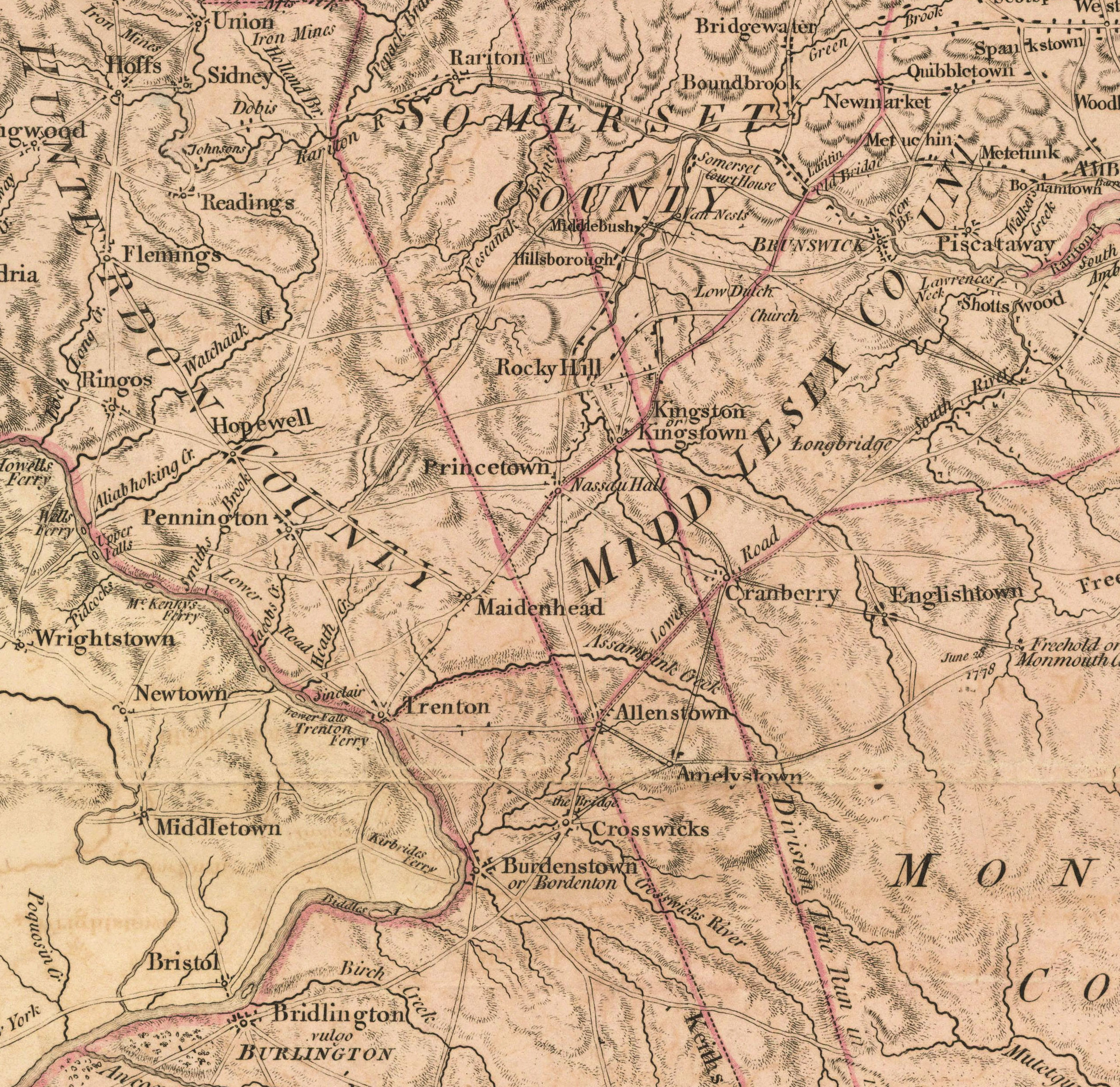
Map of Province of New Jersey (1778) – Faden – Mercer Co.
The Province of New Jersey, Divided into East and West, Commonly Called the Jerseys
Second Edition [of three] with Considerable Improvements
Engraved & Published by Wm. Faden, Charing Cross, December 1, 1778
Scale: “about 69½ British miles to a degree” (roughly 6.6 miles to 1 inch)
Copperplate map, hand-colored, Approx. 30 x 21″
Included in Faden’s North American Atlas of 1777; Also French derivative with both languages
Seminal Revolutionary War-era map of New Jersey – East/West Division, N.Y. Boundary
Shows two boundary lines bisecting the state between the old colonies of East and West Jersey
First to depict resolved northern border with New York (1743, 1769)
– Trenton, Princetown, Rocky Hill, Pennington, Ringos, Flemings, Hillsboro
– Second edition adds Hopewell
Tag – NJ
File – 1778-NJ-Faden-PrUniv-MercerCo-crop.jpg
Hopewell Valley History Project
Preserving Our History