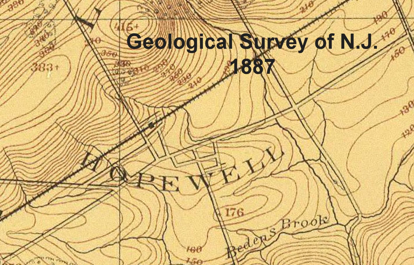
Hopewell Borough – detail
Topographical map of Flemington from Somerville and Princeton to the Delaware (1887)
in Atlas of New Jersey. Geological Survey of New Jersey (1888)
Julius Bien & Co., New York, 1988
A topographical map of the vicinity of Flemington,
from Somerville and Princeton westward to the Delaware
Atlas sheet no. 5, southwestern red sandstone
George H. Cook, State Geologist, C.C. Vermeule, Topographer. 1887
Tag – HwBoro
File – 1887-NJ-Atlas-Topo-Flemington-Bien-DR-crop-HwBoro.jpg
Hopewell Valley History Project
Preserving Our History